

To check wildfire risk before heading to the Mediterranean, start with EFFIS (Copernicus) for the continent-wide picture, then check the official map for the country you’re visiting for finer detail. Every country around the basin publishes its own daily risk map: Météo-France (4 levels, published at 5pm), Greece’s civil protection service (500 m resolution, 3.30pm) or Spain’s AEMET (new IPIF index since May 2026). These tools are structural and updated daily, so they stay useful season after season, unlike the casualty and hectare tallies of any single summer. Before you travel, always cross-check the national map with the official site for your exact destination.
A red warning map showing up the day before you land in Provence, Sicily or the Peloponnese doesn’t mean your holiday is cancelled, but it’s worth reading before you book a transfer into a forested area. Wildfires have become a structural feature of the Mediterranean summer since 2021: in 2025, more than a million hectares burned across the EU according to the Joint Research Centre (JRC), an outright record since records began. In late July 2026, a fresh wave is hitting Spain, France, Italy and Greece all at once. The good news is that every country around the Mediterranean basin publishes its own official risk map, free and updated daily: you just need to know which one to check, when, and what it actually means for your trip.
EFFIS: the reference map for the whole Mediterranean
A pan-European tool run by the European Commission
The European Forest Fire Information System (EFFIS) is run by the European Commission’s Joint Research Centre, folded into the Copernicus emergency service since 2015. According to EFFIS, the system draws on an expert network spanning 43 countries built up since 1998, and holds close to 2 million individual fire records dating back to 1980 for the five countries historically hit hardest: France, Greece, Italy, Portugal and Spain.
Highlights
- The « Current Situation Viewer » shows active fires and the season’s burnt areas, updated daily
- The « Wildfire Risk Viewer » combines weather-based danger and vulnerability into a single index
- The only tool that covers the whole Mediterranean basin and beyond in a single view
France: Météo-France, prefectural orders and the Calanques case
The Météo des forêts informs, prefectural orders regulate
According to Météo-France, the « Météo des forêts » (forest fire weather forecast) is published every day at 5pm for the following two days, with 4 levels — green, yellow, orange, red, meaning low, moderate, high, very high — at département level, for the campaign running from 28 May to 30 September 2026. This tool tells you about weather-based danger, but it’s the local prefectural orders (arrêtés préfectoraux) that actually regulate access to forested areas, a distinction many travellers miss. The FCDO’s own advice for France flags the same Mediterranean coast, Corsica and south-west as the highest-risk areas, and tells British travellers to check this same fire alert map before setting off.
The Calanques de Marseille example
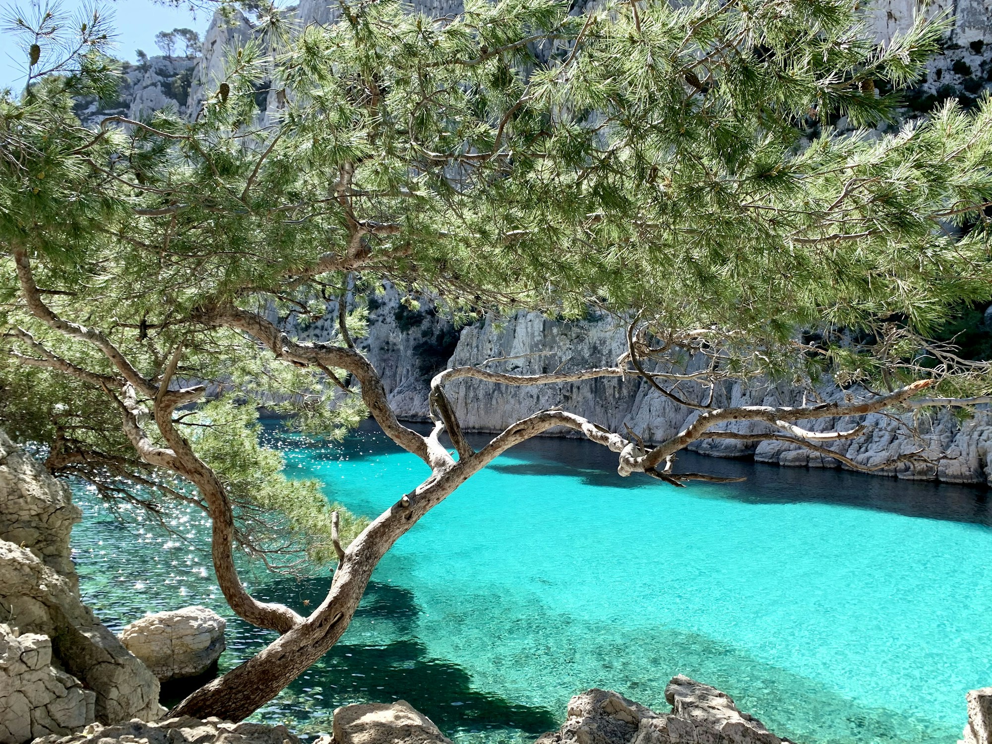
Calanques National Park runs its own 4-colour code, separate from the Météo des forêts: green (normal access), yellow (access maintained but any ignition source banned), orange (trails closed but boat access maintained, including approaching the cliffs from the sea), red (total closure, including boat landings). According to Marseille Spirit, this is published every day at 6pm for the following day, on calanques-parcnational.fr and the « My Calanques » app. On 26 July 2026, for example, every forested area in the Var was closed to the public, and by the next day the Esterel-Tanneron massif had moved to very severe risk: this kind of overnight swing is exactly why you check the day before, never the week before.
- Clear split between information (Météo des forêts) and regulation (prefectural order)
- FR-Alert: automatic location-based notification, no sign-up required
- Official advice: smoke is danger number one, not the flames
Greece: civil protection, GR-Alert and the mAiGreece app
A 500-metre-resolution map, published every afternoon
Greece’s General Secretariat for Civil Protection publishes a wildfire risk map for the following day at around 3.30pm, at a resolution of 500 x 500 metres, on a 5-colour scale from very low to extreme. According to civilprotection.gov.gr, this map is backed up by the GR-Alert system (bilingual Greek-English location-based SMS, no sign-up needed — just keep your phone’s location turned on) and by the mAiGreece app, a Tourism Ministry assistant available in 31 languages including English, with a built-in 112 emergency button.
Highlights
- Total ban on outdoor fires, including barbecues, from May to October (fines of up to €50,000)
- Starting a wildfire, even unintentionally, is a criminal offence in Greece
- The official @112Greece account relays alerts in real time
Italy: Protezione Civile, Sicily and Puglia under pressure
The Bollettino nazionale di previsione incendi boschivi (national wildfire forecast bulletin) is published every day by the Dipartimento della Protezione Civile, with 3 levels (low, medium, high) at provincial level, giving a 24-hour forecast plus a 48-hour trend. According to the Protezione Civile, the official « Antincendio Boschivo » (AIB) fire season runs from 15 June to 15 October, with frequent local bans and fines of up to €50,000. The UK’s FCDO travel advice for Italy echoes the same message, describing wildfires as dangerous and unpredictable and recommending you check current alerts, weather forecasts and local instructions before heading into affected areas — and make sure your travel insurance covers wildfire-related evacuation and trip interruption.
On 26 and 27 July 2026, a fire near Peschici in Puglia triggered a sea evacuation of more than 400 tourists and swimmers, according to ANSA, with the SP52 coastal road closed and around 300 campers rehoused in Vieste. Seven Italian regions were hit in 2026 — Sicily, Calabria, Molise, Sardinia, Puglia, Umbria and Tuscany — for a total of 36,600 hectares burned between 1 January and 22 July 2026 according to Geopop, roughly 80% above the 2006-2025 average for the same period.
Sicily and Sardinia have already had their share of dramatic episodes: in 2023, a fire near Palermo shut the city’s airport and disrupted Catania’s; in 2021, the Montiferru fire in Sardinia burned between 13,000 and 20,000 hectares. If these islands still appeal to you, it’s worth building some flexibility into your trip: our 5-day Sicily itinerary across Palermo, Taormina and Etna is a solid base to adjust around whatever the day’s map is showing.
Spain: AEMET, incendiosespaña.es and the summer 2026 crisis
AEMET launched a new index in May 2026, the IPIF (Índice de Peligro de Incendios Forestales), replacing the old system and sharpening spatial resolution from 5 km down to 1 km. According to AEMET, the new index combines standard weather parameters with satellite data on vegetation condition and soil moisture, on a 6-level scale. On top of that, incendiosespaña.es and the « wildfires » layer on Google Maps are explicitly recommended in the UK government’s own travel advice for Spain, which also points British travellers to AEMET for fire-risk information and reminds them that causing a wildfire, even unintentionally, is a criminal offence there.
As of 27 July 2026, a major crisis was under way around Madrid: three fires that merged in the Sierra Oeste on 24 July led to a national emergency declaration covering Madrid, Ávila and Toledo, with roughly 34,000 hectares affected on the Madrid side alone. According to a 25 July 2026 update reported by La Jornada, up to 88,060 people had been evacuated or confined to their homes, with reinforcements arriving from Greece, Italy, Portugal and Turkey. An earlier fire at Los Gallardos (Almería province, Andalusia) between 11 and 15 July 2026 left 13 confirmed dead according to Euronews — seven of them British nationals — making it the country’s deadliest wildfire in 40 years. These figures move fast: for the day’s actual situation, always check incendiosespaña.es rather than a dated article.
Portugal: IPMA, MapaFogos.pt and the Delta deployment
Portugal’s IPMA publishes its « Perigo de Incêndio Rural » (PIR, rural fire danger) index at municipal level, with tighter restrictions — on burning, farm machinery, access to rural areas — kicking in at the highest levels. The site MapaFogos.pt aggregates official ICNF data and refreshes every 10 minutes, a useful pace once the season is in full swing. The FCDO’s own Portugal advice, expanded again on 9 July 2026, doesn’t advise against travel but does flag wildfire risk directly, telling British visitors to check the fire risk index for their area and keep an eye on local civil protection instructions.
For 2026, Portugal’s national civil protection authority (ANEPC) activated its highest readiness level, known as « Delta », deploying 15,149 personnel and 81 aircraft through to 30 September — the country’s biggest firefighting operation in a decade. In early July 2026, a fire that started near Vouzela (Viseu district) peaked on 3 July with more than 3,000 firefighters tackling 92 simultaneous incidents nationwide, with that single blaze alone burning 12,160 hectares according to The Portugal Post. The 2026 crisis was concentrated in the Centre and North rather than the Algarve, which had its own episode in September 2025 between Aljezur and Lagos — a stretch of coast that alone accounts for 57% of British overnight stays in Portugal, making it especially relevant if you’re planning a trip there.
Croatia, Turkey, Cyprus: three more basins to watch
Croatia
Croatia’s national weather service (DHMZ) publishes general weather alerts on a 4-level scale but doesn’t run a dedicated public wildfire map. According to The Dubrovnik Times, Split-Dalmatia county is rated « very high risk » and Dubrovnik-Neretva « high risk » under Croatia’s national assessment. Between 15 June and 21 July 2026, the Croatian air force responded to 33 fires along the Adriatic coast. If the region still tempts you, a cruise along the Dalmatian coast is a good way to keep your itinerary flexible.
Turkey
Turkey’s General Directorate of Forestry (OGM) publishes a percentage-based risk map, with consistently very high risk in the Aegean region (Muğla, covering Bodrum and Marmaris) and the Mediterranean coast (Antalya). As of 22 July 2026, five provincial fires had been brought under control quickly, according to Wego Travel Blog, with no airport disruption — unlike the 2021 episode in Marmaris and Bodrum, which required evacuations by boat. The FCDO flags the same April-to-October risk window for Turkey and, while it doesn’t advise against travel to the main resorts, recommends following local instructions if a fire breaks out nearby.
Cyprus
Cyprus’s Department of Forests runs a 4-pillar system — prevention, detection, pre-emptive measures, suppression — with a dedicated free number, 1407. The most heavily documented fire, near Limassol in July 2025, burned 130 km² and destroyed 224 structures; an investigation by the US Bureau of Alcohol, Tobacco, Firearms and Explosives (ATF) eventually concluded it was accidental (an improperly stubbed-out cigarette), despite initial suspicion of arson, according to the Department of Forests. The coastal tourist areas of Paphos and Limassol weren’t affected, and Larnaca and Paphos airports stayed fully operational throughout.
What this actually means for your holiday
A wildfire near your destination can cause several different types of disruption, well documented year after year. On the site closures side: Vesuvius’s hiking trails closed in 2025 without affecting the Pompeii archaeological site nearby, which stayed open despite visible smoke; Palermo airport shut in 2023; and forested areas in Provence regularly close under prefectural order during peak season.
On the campsite and hotel evacuations side: Argelès-sur-Mer, in the Pyrénées-Orientales, saw 4 campsites and around 3,000 holidaymakers evacuated as a precaution in 2026; in Catalonia, a children’s summer camp was evacuated on the Costa Brava; and in Peschici, more than 300 campers were rehoused in municipal gyms.
On flights, Jet2 and TUI — two of the biggest UK holiday operators — cancelled all their flights and package holidays to Rhodes in July 2023, according to ITIJ, offering travellers a full refund or a free rebooking. On ferries, Greek routes to Paros, Naxos and Milos were suspended several times in 2026 because of strong winds and smoke — a different issue from seafarers’ strikes: if you’re planning some island-hopping, our travel safety apps comparison helps you cross-check both types of disruption at a glance. And on air quality, fine particle (PM2.5) concentrations topped 100 µg/m³ in Bordeaux during the July 2026 crisis according to NPR, well above the WHO’s recommended daily safety threshold of 15 µg/m³.
Cancellation cover, flight compensation: what your policy actually covers
Package holidays are protected too, though the exact rulebook depends on where you booked. Under the UK’s own Package Travel and Linked Travel Arrangements Regulations 2018 (topped up by a 2026 amendment), Regulation 12(7) lets you cancel without a fee if « unavoidable and extraordinary circumstances » at your destination significantly disrupt your trip, and the organiser must refund you in full within 14 days. The EU has a near-identical rule of its own, revised and in force since 28 May 2026, which applies if you’ve booked directly with an EU-based operator. Either way, a single flight cancelled purely because of a wildfire rarely triggers UK261/EU261 compensation: this kind of event is almost always classed as an « extraordinary circumstance », which lets the airline off the hook for a cash payout, even though it must still offer care and a replacement flight or refund.
UK travel insurance works a little differently from what you might expect: there’s no government « natural catastrophe » declaration that triggers a payout. Cover instead hinges on official FCDO travel advice. According to the Association of British Insurers (ABI), if the FCDO changes its advice for your destination to advise against travel after you’ve booked, you should be able to cancel and claim; travelling anyway against that advice will typically invalidate your policy under any section, as insurer AllClear points out. Crucially, if wildfires were already being reported when you booked, that risk generally counts as « known » and won’t be covered, and simply feeling nervous about smoke on the horizon doesn’t qualify either. Not every policy includes this cover as standard, so it’s worth checking the small print for « natural disaster » or « travel disruption » cover before you go. To compare your options, our full 2026 travel insurance comparison breaks down what’s actually included by destination.
Finally, if wildfire risk is shaping your choice of dates, the official risk season runs from April to October according to the FCDO’s own travel advice, with a clear peak in July and August. The shoulder seasons — May-June and September-October — offer a noticeably better trade-off between budget, crowds and risk.
Practical info before you go
Cover built for international trips, with a natural disaster option that’s useful if a wildfire disrupts your accommodation or itinerary while you’re away.
From $56 / 4 weeksA wildfire rarely gets the airline off the hook completely, but a delay or cancellation for an unrelated reason can qualify you for UK261/EU261 compensation. AirHelp checks your eligibility for free.
Free eligibility checkFrequently asked questions
Which map should I check for wildfire risk before travelling to the Mediterranean?
Start with EFFIS (Copernicus) for the Europe-wide picture, then check the official map for your specific destination for finer detail: Météo-France in France, the civil protection map in Greece, incendiosespaña.es and AEMET in Spain, MapaFogos.pt and IPMA in Portugal, or the Protezione Civile bulletin in Italy.
Does a flight cancelled because of a wildfire qualify for UK261/EU261 compensation?
No, in almost every case. A wildfire is classed as an « extraordinary circumstance », in the same category as a storm, which lets the airline off the hook for financial compensation. It’s still required to offer you care, a replacement flight or a refund, as The Points Guy explains.
Does my travel insurance cover cancellation because of a wildfire?
Only if the FCDO has changed its advice for your destination to advise against travel after you booked, or your holiday provider cancels the trip outright — and only if your policy actually includes natural disaster or trip disruption cover, which isn’t always standard, according to the Association of British Insurers and insurer AllClear. Feeling nervous, or seeing smoke on the horizon, doesn’t on its own qualify you for a refund, and travelling against FCDO advice will usually void your cover completely.
What should I do if I’m evacuated from my hotel or campsite because of a wildfire?
Follow local authority instructions only — FR-Alert, GR-Alert, door-to-door warnings, loudspeakers — and never set off on foot in front of the fire on your own initiative. Get away from the smoke first: it’s danger number one, according to French disaster-risk agency Géorisques, so take shelter in a solid building or a vehicle before contacting your tour operator or insurer.
What’s the best time to visit the Mediterranean while limiting wildfire risk?
May-June or September-October, outside the July-August peak where almost all the major fires recorded between 2021 and 2026 have broken out. The official risk season runs from April to October, according to the FCDO’s own travel advice (FCDO).
Do major tourist sites automatically close if there’s a wildfire nearby?
No, it depends entirely on the site. In 2025, Vesuvius’s hiking trails closed, according to Travel And Tour World, while the Pompeii archaeological site right next door stayed open despite visible smoke. The Calanques near Marseille, for their part, use a daily colour code that can close the trails while leaving boat access open. Always check the official site for your exact destination on the day itself.
Can I have a barbecue or campfire on a Mediterranean summer holiday?
No, not in almost any country around the basin during the risk season. Greece bans all outdoor fires from May to October, with fines of up to €50,000 according to Nikana; Italy runs its « Antincendio Boschivo » season from 15 June to 15 October; and France tightly regulates the use of fire through prefectural orders.
Sources
- EFFIS, Copernicus — Current Situation Viewer and Wildfire Risk Viewer
- Joint Research Centre (JRC) — 2025 report, worst wildfire season on record in the EU
- Météo-France — Météo des forêts
- GOV.UK — France travel advice, safety and security (FCDO)
- Marseille Spirit — summer access rules for the Calanques
- Géorisques — what to do in case of a wildfire
- Greek Civil Protection — wildfire risk map
- Greek Ministry of Tourism — mAiGreece app
- GreekReporter — 60 wildfires in one day, 5 July 2026
- Timeout — Southern Europe travel safety, July 2026
- GOV.UK — Greece travel advice, safety and security (FCDO)
- Italian Protezione Civile — national wildfire bulletin
- GOV.UK — Italy travel advice, safety and security (FCDO)
- ANSA — evacuations at Peschici, 26 July 2026
- Geopop — Italy wildfire tally, 22 July 2026
- AEMET — new IPIF index, May 2026
- GOV.UK — Spain travel advice, safety and security (FCDO)
- Comunidad de Madrid — Sierra Oeste fire, July 2026
- La Jornada — 88,060 evacuated and confined, 25 July 2026
- Euronews — Los Gallardos wildfire toll, 15 July 2026
- IPMA — Perigo de Incêndio Rural
- MapaFogos.pt — real-time wildfire tracking in Portugal
- The Portugal Post — Vouzela fire, July 2026
- The Dubrovnik Times — aerial firefighting resources in Dalmatia, summer 2026
- Wego Travel Blog — Turkey wildfire safety update, 2026
- Department of Forests, Cyprus — wildfire management
- ITIJ — Rhodes flight cancellations, 2023
- NPR — air quality during the July 2026 crisis
- Council of the European Union — revised Package Travel Directive
- legislation.gov.uk — The Package Travel and Linked Travel Arrangements Regulations 2018
- legislation.gov.uk — The Package Travel and Linked Travel Arrangements (Amendment) Regulations 2026
- The Points Guy — EU261/UK261 guide
- Association of British Insurers (ABI) — travel insurance advice for wildfires in France and Spain
- AllClear Travel — travel advice on European wildfires
Research conducted on 28 July 2026. Sources consulted and verified; the official maps cited are authoritative for the day’s situation.

Plan your trip with Pixidia
Pixidia learns how you travel and helps you build a trip that truly fits you and everyone coming along.
Open the planner