
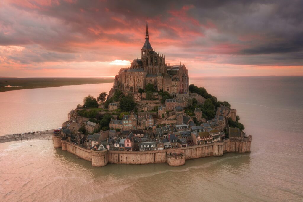
The September 2026 spring tides at Mont Saint-Michel run in two windows: Thursday 10 to Monday 14 September, peaking on Saturday 12 at 9:02 pm (coefficient 101, 12.79 m), then Saturday 26 to Wednesday 30 September, peaking on Monday 28 at 9:12 pm (coefficient 99, 12.60 m). To watch the tide come in, get into position two hours before high water.
In September 2026, the Bay of Mont Saint-Michel experiences two equinox spring tide windows: 10-14 September, then 26-30 September. The month’s highest tide reaches 12.79 m on Saturday 12 September at 9:02 pm, one centimetre below the island threshold: the water encircles the rock, the passage through the rocks is briefly blocked, and the sight of the flood tide covering the salt meadows plays out right at sunset. This guide gives the exact times of both windows, the official water heights from the Établissement public du Mont-Saint-Michel, the best viewpoints and the safety rules that apply on a 200 km² tidal flat.
1. The two September 2026 spring tide windows

From Thursday 10 to Monday 14 September, then Saturday 26 to Wednesday 30
Spring tides follow the lunar phases: the first window brackets the new moon on Friday 11 September, the second the full moon of Saturday 26 — the Harvest Moon. At the equinoxes, the Sun’s alignment with the equator amplifies the effect, and the Bay of Mont Saint-Michel holds the record for continental Europe with a tidal range that can exceed 14 metres, according to Normandie Tourisme. In Europe, only the Severn Estuary in the UK does better, with ranges of up to 15 m. According to the “Tide information 2026” booklet from the Établissement public du Mont-Saint-Michel (EPMSM), the month’s highest tide reaches 12.79 m on Saturday 12 September at 9:02 pm (coefficient 101), one centimetre below the 12.80 m island threshold; on Monday 28 September at 9:12 pm, the second window peaks at 12.60 m (coefficient 99).
High tide times for both windows (Bay of Mont Saint-Michel, official EPMSM times)
| Date | Morning high tide | Evening high tide | Max height of the day |
|---|---|---|---|
| Thu 10 Sep | 7:28 am (coef 90) | 7:43 pm (coef 95) | 12.28 m |
| Fri 11 Sep | 8:11 am (coef 98) | 8:25 pm (coef 101) | 12.70 m |
| Sat 12 Sep | 8:49 am (coef 102) | 9:02 pm (coef 101) | 12.79 m |
| Sun 13 Sep | 9:24 am (coef 100) | 9:36 pm (coef 97) | 12.60 m |
| Mon 14 Sep | 9:55 am (coef 93) | 10:07 pm (coef 89) | 12.21 m |
| Sat 26 Sep | 7:45 am (coef 87) | 8:02 pm (coef 92) | 12.17 m |
| Sun 27 Sep | 8:20 am (coef 95) | 8:37 pm (coef 97) | 12.50 m |
| Mon 28 Sep | 8:54 am (coef 99) | 9:12 pm (coef 99) | 12.60 m |
| Tue 29 Sep | 9:28 am (coef 98) | 9:46 pm (coef 96) | 12.46 m |
| Wed 30 Sep | 10:01 am (coef 92) | 10:21 pm (coef 88) | 12.23 m |
The tourist office times reproduce the SHOM forecasts from Saint-Malo, shifted by 5 minutes for the bay. The evening tides (high waters between 7:43 pm and 10:21 pm) coincide with sunset in September: on Saturday 12, the incoming tide meets the golden hour around 8:15 pm, then the blue hour. Both windows also bracket two free events: the European Heritage Days on 19-20 September (free entry to the abbey) and the Saint-Michel feast day on Tuesday 29 September, which falls in the second window according to the Mont Saint-Michel abbey.
Highlights
- The month’s highest tide on Saturday 12 September: 12.79 m, 1 cm short of the island threshold
- Evening tides right at sunset: golden hour then blue hour over the bay
- Smaller crowds after summer, mild weather (16-17 °C) and two free events in the month
2. Does Mont Saint-Michel become an island again in September 2026?
No, not in the strict sense. The official island threshold, defined by the EPMSM, starts at a water height of 12.80 m at the foot of the Mont: beyond it, the esplanade becomes inaccessible and the rock turns back into an island for the duration of the tide. On 12 September 2026, the sea peaks at 12.79 m — one centimetre below the threshold. Full island cut-off (heights of 13 m and above, spring tide protocol activated, traffic stopped) only happens 0 to 12 days a year, according to the EPMSM 2026 booklet.
The visual effect, however, is very much there. With 12.79 m of water, the sea completely encircles the rock and drowns the salt meadows around it. On Saturday 12 September, access to the village via the Avancée gate is impossible from 8:30 pm to 9:30 pm, while the passage through the rocks stays usable from 8:10 pm to 10:00 pm: the Mont becomes an island for one evening without fully cutting off access. One note: no coefficient exceeds 102 in September 2026 according to official sources (SHOM and EPMSM), even though some third-party sites claim 110. Those figures are wrong for 2026: September’s tides are “very beautiful” but stay below the island threshold.
The official access thresholds at the Mont (water heights at the rock, EPMSM 2026)
| Water height | Effect on access |
|---|---|
| 12.20 m | Access disrupted via the main gates and the Fanils; passage through the rocks blocked |
| 12.40 m | Regulated parking for delivery vehicles |
| 12.70 m | Full coastal flood watch on the esplanade |
| 12.80 m | Esplanade inaccessible: island risk |
| 13.00 m and above | Island cut-off: spring tide protocol, traffic stopped (0-12 days a year) |
On Saturday 12 September, the 12.79 m tide sits between vigilance and island cut-off: expect access via the Avancée gate to close for around an hour in the evening, shuttles on adjusted timings, and a show of water encircling the rock from the ramparts or the abbey’s west terrace.
3. Where to watch the tide come in: the best spots
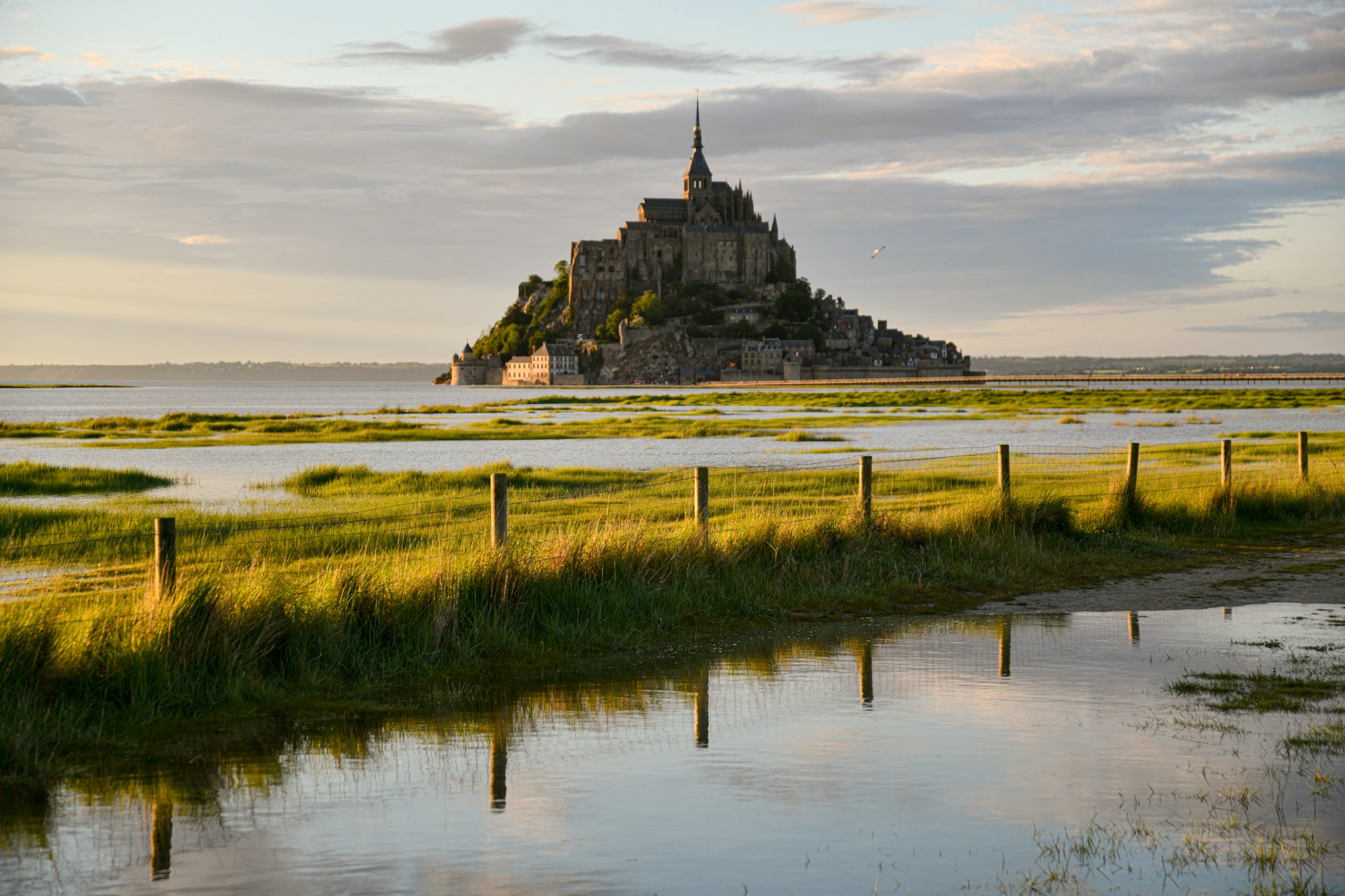
Get into position two hours before high water
The rule every photographer and guide repeats: arrive two hours before high water to watch the flood cover the salt meadows and make your way to your viewpoint, advises Normandie Tourisme. On Saturday 12 September, that means being in position from 7 pm for a 9:02 pm high tide; on Monday 28, from 7:15 pm for 9:12 pm. The best spots, all free to reach from dry land:
- Roche Torin (Courtils, at the mouth of the Sélune): the “floating Mont” view above the salt meadows, photographers’ favourite
- Pointe du Grouin du Sud (Vains-Saint-Léonard): panorama over the Mont and Tombelaine, almost deserted at sunset, car park on site
- Gué de l’Épine (Val-Saint-Père): the best view over the Couesnon estuary and the tidal bore, 1h15 before high water
- Pontaubault bridge and Couesnon dam: wide shots over the bay, long exposures at dusk
- Ramparts and west terrace (inside the walls): the bird’s-eye view of the rising sea, terrace included in the abbey ticket
Bonus for this month: the tidal bore — a wave of 50 cm to 1 m that runs up the Sée, the Sélune and the Couesnon against the current — is visible about 1h30 to 2h before high water, according to Coutances Tourisme. Experienced kayakers surf it as the big tides approach, a rare sight in Europe.
4. Walking in the bay: the golden rule of a certified guide
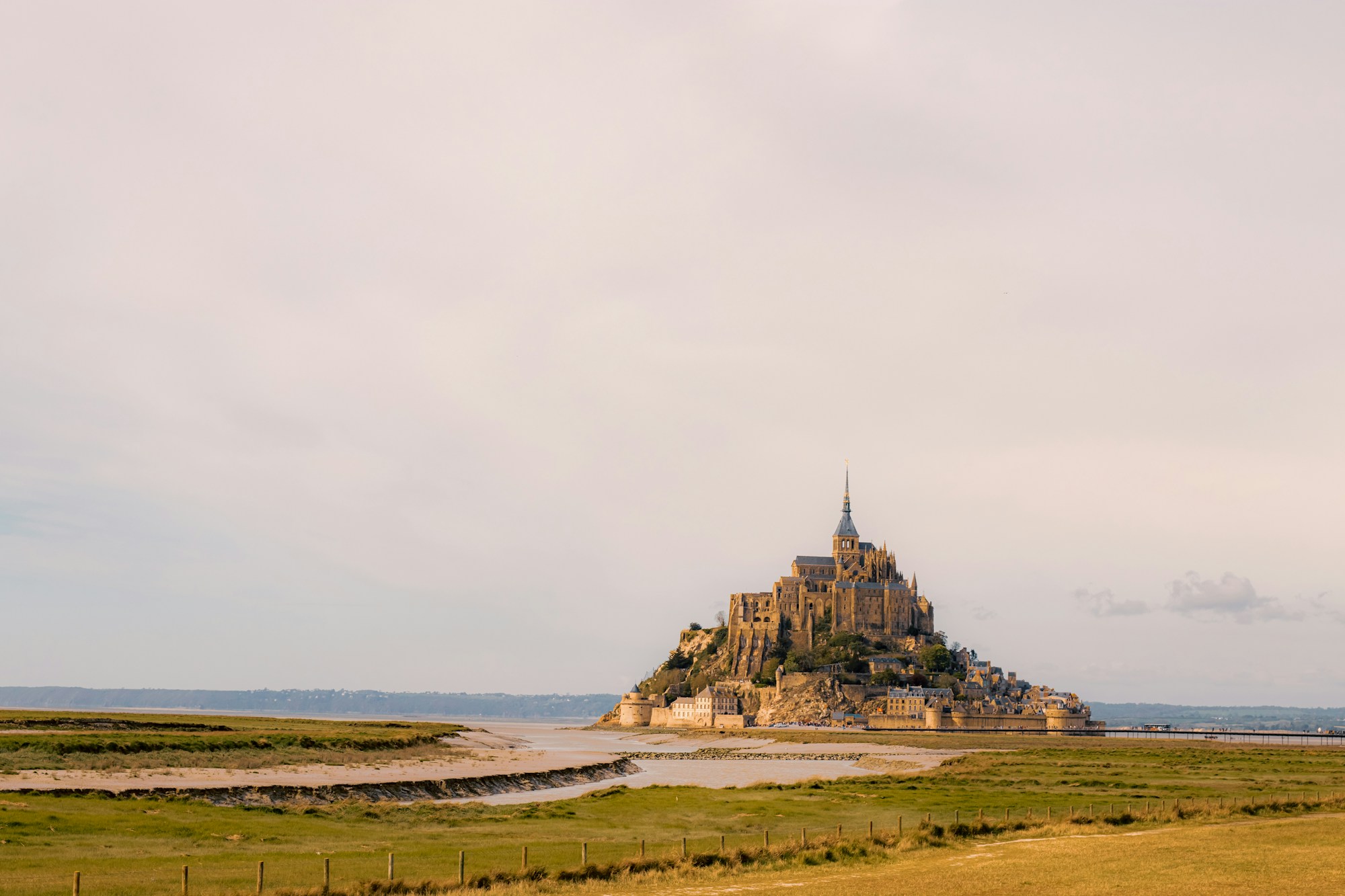
200 km² of tidal flats, shifting channels and a flood tide at 6 km/h
At low tide, the sea retreats up to 12-15 km from the coastline and uncovers 200 to 250 km² of flats, mud and salt meadows, according to Wikipedia (Bay of Mont Saint-Michel). The danger is not the speed of the flood — measured at around 6 km/h by Normandie Tourisme (Victor Hugo’s “galloping horse” was a hyperbole) — but the lay of the land: channels move with every tide, patches of quicksand hide beneath the mud, and fog can roll in within minutes.
The absolute rule: never walk the flats without a certified guide. Bay crossings only run with the 67 guides holding the certificate issued by the Avranches sub-prefecture, as Manche Tourism reminds us. A classic crossing from Genêts (Bec d’Andaine) or the Grouin du Sud covers 7 km barefoot over the mud, crossing the Sée or the Sélune, an introduction to quicksand (you get out by letting yourself float), and sometimes a stop on the islet of Tombelaine, a bird reserve you can only visit with a guide. Prices start around €10 (short walk), according to Les Traversées de Lud’o.
If in doubt or in an emergency on the flats, dial 196 (CROSS) or VHF channel 16. The maritime prefecture repeated these instructions after six people were rescued from the rising tide at Chausey on 16 August 2026, according to its statement. While you’re there, keep an eye out for harbour seals: the sedentary colony of about 120 animals — the southernmost in France — rests on the sandbanks off the Mont at low tide.
Highlights
- The guided crossing is the only safe way to walk the flats, even during spring tides
- “Big tide” outings scheduled in both windows let you watch the tidal bore from the Couesnon
- Booking 4-6 weeks ahead is recommended in season; in September, morning departures are still doable
5. Budget and logistics: abbey, parking, train, accommodation

Budget around €90 per adult for a full day
The biggest line item is the abbey: €16 full price from 1 April to 30 September 2026 (€13 from 1 October), free for under-18s and for 18-25s from the EU, according to the Centre des monuments nationaux. It is open 9:30 am-6 pm (last entry 5 pm), and the €50m restoration project launched in 2026 can close some rooms: check the schedule before your visit. On 19-20 September, entry is free for the European Heritage Days. Visitor parking is at La Caserne, 2.5 km from the rock: expect €15-25 depending on how long you stay in mid-season (some sources mention free parking in the evening, depending on the season — confirm on site), then the free Passeur shuttle every 5-15 minutes until 11 pm, or a 35-45 minute walk, according to the tourist office.
By train, Pontorson-Mont-Saint-Michel station is served by TER from Rennes (about 50 minutes) and Caen (about 2h30). From Paris, allow about 3h50 via Rennes (seasonal direct services vary according to source — the route via Rennes or Caen is the safe bet on SNCF Connect). From London, take the Eurostar to Paris (about 2h20) and connect from there: roughly seven hours door-to-door. On site, line 2 links the station to the Mont in about 27 minutes. For the night, hotels in Beauvoir (2-3 km) and Pontorson (9 km) offer the best value at €60-130, while inside the walls climbs to €180-320. On the food front, AOP salt-meadow lamb is the speciality: the sheep graze the meadows the big tides cover, which gives the meat its mineral flavour, notes the INAO. A long weekend pairs naturally with the D-Day beaches two hours away by car, and the regional picture of summer 2026 — detailed in our analysis of Normandy, Brittany and the Opal Coast: the big winners of summer 2026 — confirms the appeal of these coastlines in September.
Highlights
- Abbey free for under-26s (EU) and during the Heritage Days on 19-20 September
- Free shuttle between the parking and the rock; bikes allowed on the footbridge before 10 am and after 6 pm
- The 2026 restoration work does not close the site: only some rooms may be off limits
Practical info for the big tides
Check tide times, weather forecasts and shuttle status in real time, even while roaming. Set up takes two minutes before you leave, with a France plan.
France plans from a few eurosCancellation, medical costs, luggage: travel insurance stays a good idea even in France, especially if you are combining the Mont with several Normandy stops. Compare plans before you go.
From $56 / 4 weeksTo compare eSIMs before you go, our selection of cool summer 2026 destinations is still the reference for low-budget French coastlines.
Frequently asked questions
What are the exact dates of the September 2026 spring tides at Mont Saint-Michel?
Two windows: Thursday 10 to Monday 14 September 2026, peaking on Saturday 12 at 9:02 pm (coefficient 101, height 12.79 m), then Saturday 26 to Wednesday 30 September, peaking on Monday 28 at 9:12 pm (coefficient 99, 12.60 m). Official times.
Does Mont Saint-Michel become an island again in September 2026?
Not in the strict sense: island status starts at a water height of 12.80 m, and the tide on 12 September peaks at 12.79 m — one centimetre below. The show remains spectacular: the water encircles the rock and the Avancée gate is cut from 8:30 pm to 9:30 pm that evening.
What time should I watch the tide come in on Saturday 12 September?
Get into position two hours before high water, so from 7 pm for the 9:02 pm high tide. The tidal bore, meanwhile, is visible about 1h30-2h before, ideally from the Gué de l’Épine. The tourist office times reproduce the SHOM forecasts from Saint-Malo, shifted by 5 minutes for the bay.
Can you walk across the bay in September 2026?
Yes, but only with a certified guide (67 guides hold the certificate issued by the Avranches sub-prefecture). Crossings start from Genêts (Bec d’Andaine) or the Grouin du Sud: 7 km, about 2 hours, barefoot over the mud, from €10 depending on the option.
How much does the abbey cost in September 2026?
€16 full price (01/04-30/09/2026), free for under-18s and EU 18-25s, and free entry on 19-20 September for the European Heritage Days. Open 9:30 am-6 pm, last entry 5 pm. Source.
What are the dangers of the spring tides in the bay?
The flood rises at around 6 km/h (faster in the channels), channels move with every tide, patches of quicksand hide beneath the mud and fog can roll in suddenly. Never walk the flats alone, stay with a certified guide and dial 196 (CROSS) in an emergency.
Sources
- “Tide information 2026” booklet from the Établissement public du Mont-Saint-Michel (EPMSM) – water heights, access thresholds, passage through the rocks
- Mont Saint-Michel tourist office – 2026 tide times – reproduction of SHOM Saint-Malo forecasts
- Normandie Tourisme – spring tides at Mont Saint-Michel – flood speed, viewpoints
- Manche Tourism – bay crossings – certified guides
- Manche Tourism – 2026 spring tides – window calendar
- Mont Saint-Michel abbey (CMN) – 2026 prices and opening hours
- Maritime prefecture Manche-mer du Nord – safety instructions – statement of 16/08/2026
- Coutances Tourisme – where to see the tidal bore
- IMCCE – the big tides of the 21st century – the 3 March 2033 tide
- Les Traversées de Lud’o – options and prices
- BBC Coast – Severn Estuary – the second-highest tidal range in the world
Sources consulted on 20 August 2026.

Plan your trip with Pixidia
Pixidia learns how you travel and helps you build a trip that truly fits you and everyone coming along.
Open the planner